| Lane Home Page | Search Lane |
| Website Accessibility |
Campus Long Range Planning : Chapter Six : Putting It All Together
Series : Conceptual Vision Home : Table of Contents, Executive Summary : Chapter One : Chapter Two : Chapter Three : Chapter Four : Chapter Five : Chapter Six :
This Page : Developing the level of detail : Twelve Schemes / Aerial View : Campus Quads : Nodal Development Along I-5 : Preserve the Wetlands : Preserve the LCC Forest : Short Walks : Preserve the Recreation Fields : Connect to Nature : Develop a Campus Gateway : Housing on the South Side : Perimeter Parking : Twelve Schemes and Common Themes :
: Development Option One : Description : Strenghts : Weaknesses : Attributes : Map :
: Development Option Two : Description : Strenghts : Weaknesses : Attributes : Map :
: Development Option Three : Description : Strenghts : Weaknesses : Attributes : Map :
: Evaluation Workshop : Appropriate Infrastructure : Complete Communities : Sustainable Building and Landscaping Practices : Equitable Access : Graph :
: Development Option Four Revised : Description : Attributes : Map : Strenghts : Issues : : Phase 1 : Phase 2 : Phase 3 : Existing Conditions : Area Development Boundaries :
: Development Option Five LCC Owned Land : Description : Attributes : Map :
: Revised Development Option 5: Second Phase Land Swap : Description : Attributes : Map :
: Revised Development Option 5: Third Phase Parcel Purchase : Description : Attributes : Map :
The collaborative consensus-building exercises have allowed
the Urban Design Lab to develop a quality conceptual
vision proposal - for consideration by LCC’s shared
governance system - that considers LCC faculty, staff and
student opinions, preferences and experiences along with
community input, as opposed to non-user, donor interests.
This chapter follows the third step described in Hamdi
as program agreement. This step consists of a review and
evaluation of alternative approaches, which are measured
against the vision, goals, and principles developed throughout
the planning process that are “based on the balance
between feasibility and desirability” (Goethert and Hamdi
1988, 22). Alternative approaches 1-3 and the preferred
alternative described in this chapter were drafted at the
University of Oregon’s School of Architecture and Allied
Arts, in an architecture studio. The design workshop operated
like a professional firm to create draft alternative visions
for Lane Community College that used the lessons learned
from the case studies presented in the comparative mapping
exercise (chapter three), guided by the design vision,
principles, and goals (chapter five), and the survey findings
(appendix III). Throughout the process, the design team met
periodically with the stakeholder group (LCC) and used
these sessions as a forum for mutual learning where new
and modified information was presented, valuated and
discussed. This iterative process created a realm to facilitate
discussion, to hear feedback and to direct the draft designs.
Defining the level of detail. The development program
is intentionally vague; therefore there are no designated
building uses or potential programming needs that were
specifically designed during the schematic design phase.
Parking calculations are based on existing and proposed
spaces, keeping in mind that in the design development
stage, specific buildings will have particular requirements.
Working with a two-phase programming process, (1) planning
and (2) schematic design; did not allow for a higher
level of detail and was outside of the scope of this project.
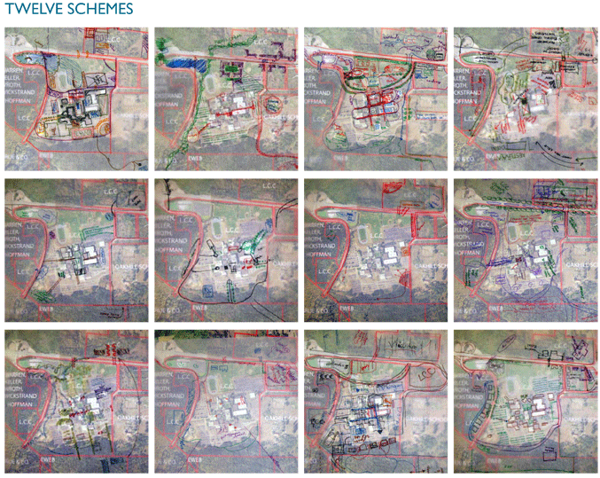
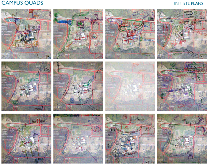
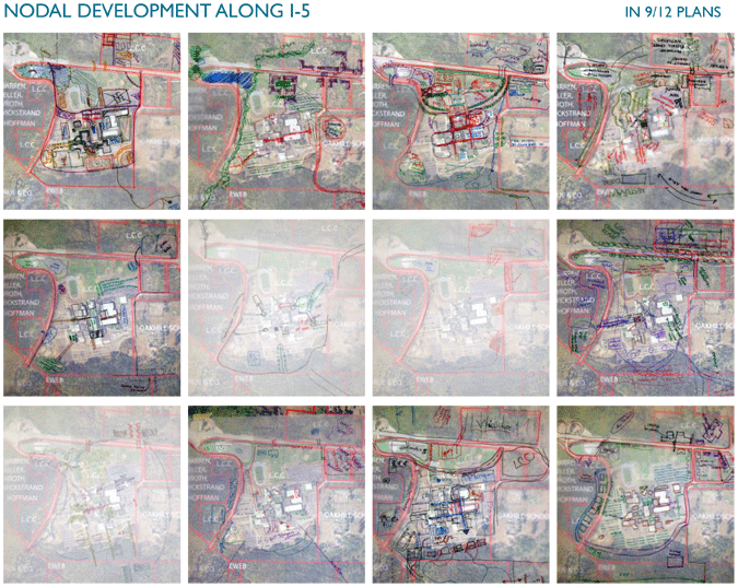
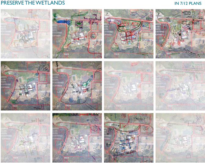
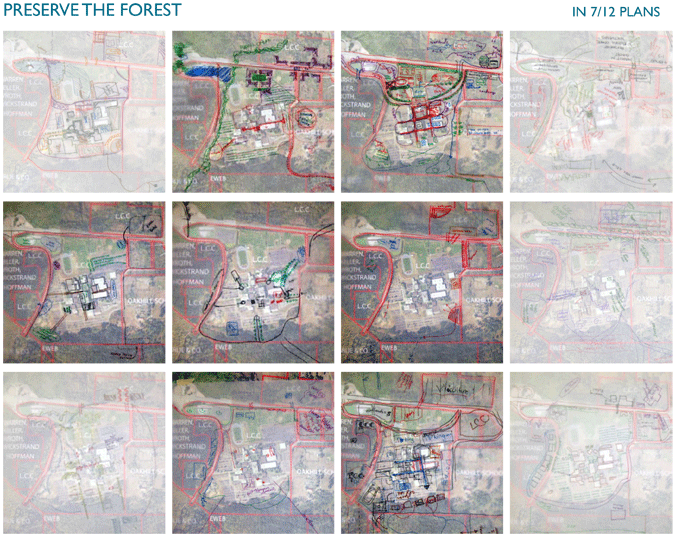
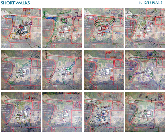
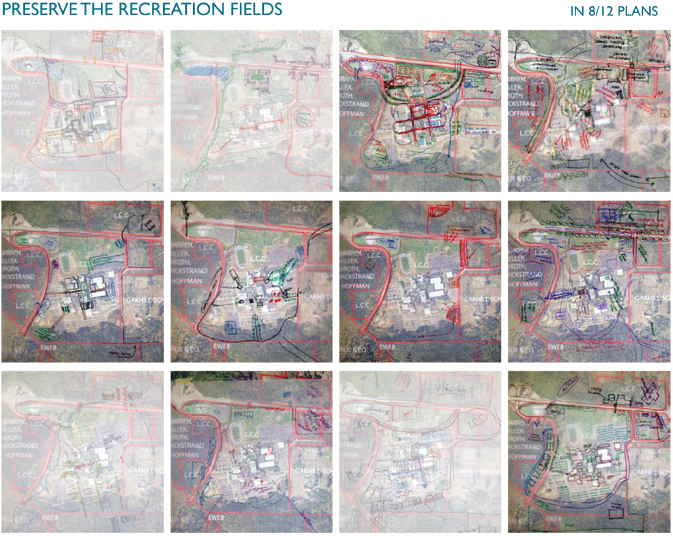
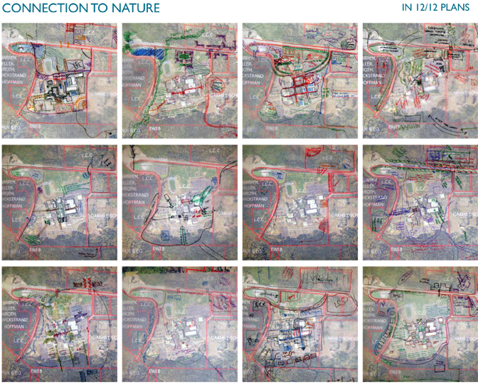
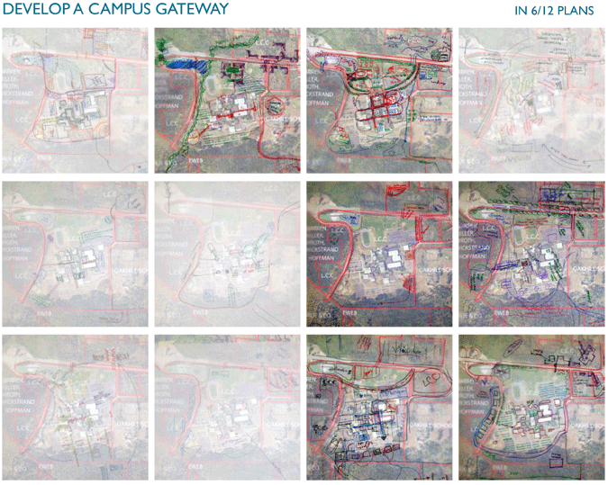
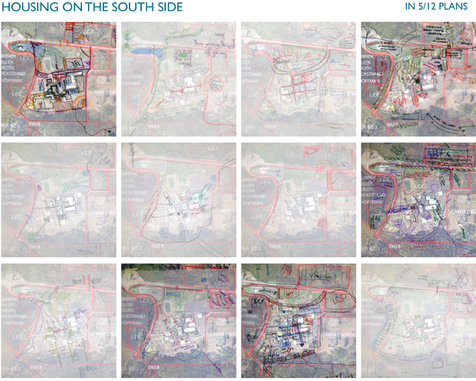
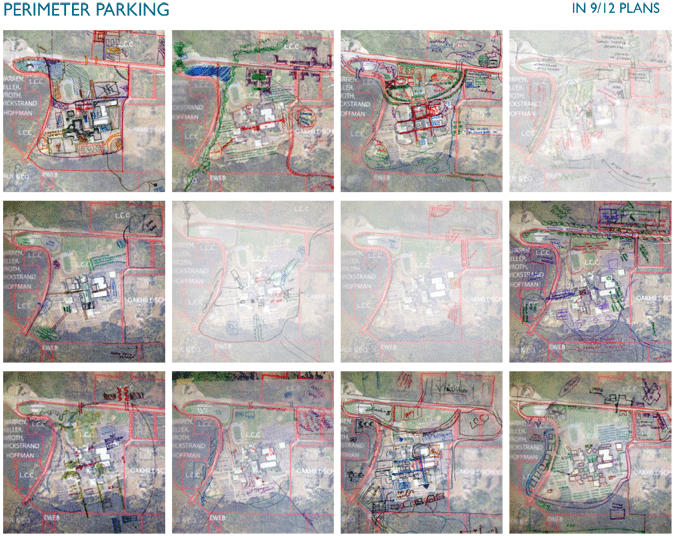
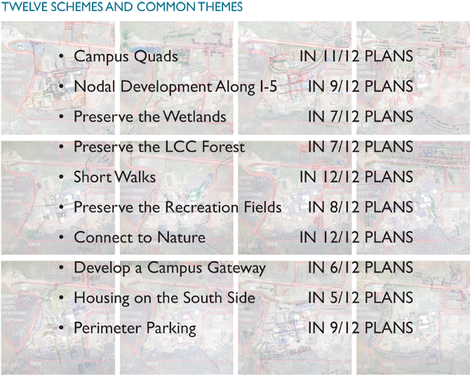
During the two visioning workshops the participants developed twelve concept development schemes based on the current and future themes gathered during the planning phase of the workshop. Each of these concept development schemes was consulted as the Urban Design Lab proceeded with the design process.
Some key ideas that emerged from the workshops are:
- Campus Quads
- Nodal Development Along I-5
- Preserve the Wetlands
- Preserve the LCC Forest
- Short Walks
- Preserve the Recreation Fields
- Connect to Nature
- Develop a Campus Gateway
- Housing on the South Side
- Perimeter Parking
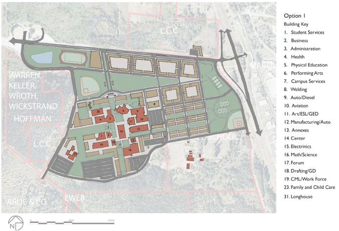
Option one focuses less on perimeter land and more on
land adjacent to the core, while assuming land could be
purchased from the Oak Hill School and by removing building
numbers three, seven and seventeen on the campus
core. The removal of these buildings is key to creating open
space within the campus core, hence creating better civic
structure and wayfinding. This alternative creates a main entrance
drawing LCC users directly into campus, as opposed
to along the perimeter. It also develops along 30th Avenue,
and moves the playing fields to create a recreation district
to the northwest. The new institutional buildings, running
east west and north south; start to frame new quads and
uses the quads as park blocks and green-connectors; additionally
creating view corridors. Diagonal, and parallel on
street parking is added.
• Creates a good entry to campus
• Recreation district allows for separation of uses
• Creates well defined circulation routes
• Addition of green-spaces in core helps add to civic structure of campus
• Concerned with view in and out of campus.
• Less development along 30th Avenue
• Assumes development of property not owned by LCC
• Demolition of three buildings
| PARKING | NEW BUILDINGS (in square feet) | BUILDABLE PARCEL AREA |
| on street --- 1,356 | spaces minimum --- 2,001,532 | 28 acres |
| off street --- 2,775 spaces | maximum --- 3,581,865 | |
| spaces gained --- 892 |
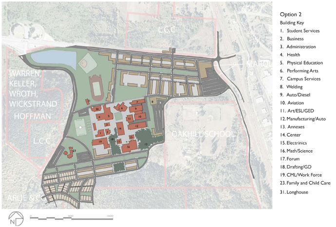
Option two focuses on higher-density development along
30th Avenue, on currently owned LCC property; and creates
a neighborhood development node to the southwest.
It builds out from existing core campus with minimal building
demolition. The removal of building eighteen allows for
a stronger connection to surrounding forest and reinforcing
the north south quad through campus. A new entrance
and approach to campus from 30th Avenue could allow
for a new transit hub central to the campus and proposed
development. Consolidating the sport fields can create an
athletic perimeter along western edge of campus. This alternative
assumes that all new roads have parallel parking on
both sides, with the potential for development of a parking
structure on the lot east of building 12, using phased development.
Buildings on 30th Avenue create opportunities
for entrepreneurial pursuits: living learning, grocery, culinary
institute, and senior center; housing to the south, keep the
current density on LCC’s main parcel and leaving the wetlands
and oak habitat undeveloped.
• Preserves current campus core
• East-west park blocks add to civic structure, paths and wayfinding
• Preservation of stormwater storage in lagoons
• Keeps track in existing location
• Weak entry sequence
• Concerned with view in and out of campus.
• Large parking in northeast corner is far from campus
• Too much development along 30th Avenue
| PARKING | NEW BUILDING (in square feet) | BUILDABLE PARCEL AREA |
| on street --- 2,971 spaces | minimum --- 2,228,095 | 42 acres |
| off street --- 1,025 spaces | maximum --- 3,757,531 | |
| spaces gained --- 757 |
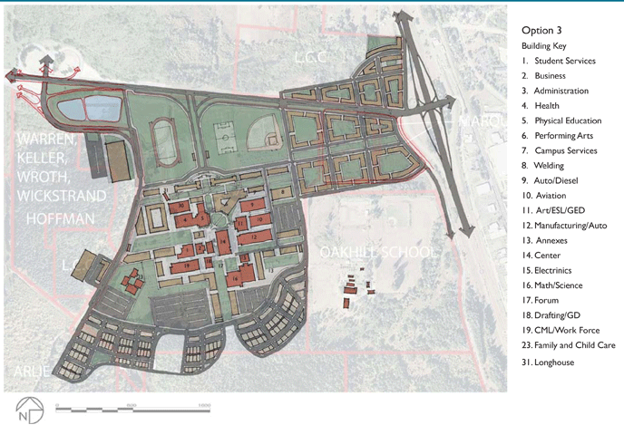
Option three focuses on a higher density mixed use, commercial
district near the I-5 interchange and a recreation/
central park concept separating the mixed-use district from
the campus. This vision expands the lower density neighborhood
to the south. An entry sequence leads through a
gateway of buildings and reinforces the recreation/central
park district, shaping the road and entrance to bring people
in. Additional key gateway buildings are proposed just north
of existing buildings five and six - creating an ‘Acropolis of
knowledge’. The removal of building eighteen reinforcing thenorth south quad through campus and creates an identifiable
courtyard at the southern entrance to the Center
building. The south side lower density housing could be possible,
assuming a land-swap would be amenable. Creating a
green-connection to the campus saves the oak habitat. By
acquiring the Marquess Trust, the north side of campus proposes
higher density housing, retail and commercial, while
developing up to I-5, allowing room for a visual landscape
barrier, and proposes to build up along 30th Avenue. The avenue could be developed into a modified multiway boulevard,
with wide medians between thru lanes and access lanes
on the south side. Additional development could be focused
at the edge of the wetlands on existing fill. On street and scattered
parking lots would handle parking.
• Generates hierarchy of open space, quads and recreation district
• Creates prominent, clear entry gateway
• Develops a strong connection with nodal development up to I-5
• Strong commitment to housing
• Places housing in hills with optimal views of campus and beyond
• Concern for wetlands along north side of 30th and edge of forest to the south
• Concerned with view in and out of campus.
• Development along 30th is not appropriate
• Housing may not take into consideration topography
| PARKING | NEW BUILDING (in square feet) | BUILDABLE PARCEL AREA |
| on street --- 2,462 spaces | minimum --- 3,042,914 | 51 acres |
| off street --- 1,101 spaces | maximum --- 5,505,117 | |
| spaces gained --- 324 |
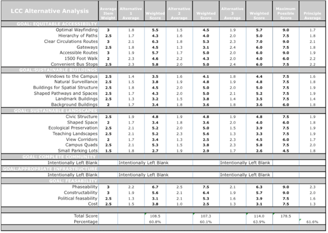
The Urban Design Lab held a third workshop that presented
the vision statement, broad goals and guiding principles
to eighteen participants. Prior to this workshop, a survey
was sent out to the LCC stakeholder group asking them
to rank the design goals, weighting each item on a scale of
1 (not important) to 3 (important). The average of the
rankings became the Average Item Weight. The workshop
reviewed the evaluation criteria and deemed 36 of the
principles to be too detailed to effectively rate the draft
alternative visions at the schematic stage of the design . The
following goals were removed:
Hidden Infrastructure, Recycling Places, Hidden Building Support, Accessible Building Support
Places to Learn, Campus Cafes, Campus Housing, Campus
Retail, Places to Play
Sustainable Building and Landscape Practices:
Oriented to Sun and Wind, Four Story Limit, Narrow Buildings, Perimeter Support Buildings, Identifiable Entries, Covered Walkways, Articulated Walls, Adapted Buildings, Entries on Public Spaces, Active Ground Floors, Entrance Transitions, Green Roofs, Classrooms with Views, Varied Seating, Offset Outdoor Seating, Seating Along Pathways, Places to Smoke, Legible Landscapes, Art on Campus, Street Trees, Bioswales, Ecological Preservation & Restoration
Connected Sidewalks, Great Streets, Safe Access for Bikes, Accessible Entries, Safe Access for Pedestrians
The most important criterion was Optimal Wayfinding (3.0), Clear Circulation Routes (3.0) and Accessible Routes (3.0). Four principles were added to the Goal of Feasibility: Phaseability, Constructability, Political Feasibility, and Cost. Of these new principles, the most important criterion was Phaseability (3.0) and Constructability (3.0).
At the evaluation workshop, the participants evaluated
each draft alternative vision against the criteria. We used
a 3-point scale: 1 (does not meet criteria) to 3 (meets
criteria), then developed a weighted average by multiplying
the average item weight of the criteria against the weighted
average of the draft alternative vision for each criterion. For
example, optimal wayfinding had an average item weight
of 3.0; Alternative 1 scored an average of 1.8 for optimal
wayfinding. We then multiplied 3.0 by 1.8 to get a weighted
average of 5.5. These were then added to create a total
score and that total score was divided against the maximum
possible total to achieve a percentage score for each
building type.
The results are very close for alternatives one (60.8%) and two (60.1%) with alternative three scoring the highest, with a rating of 63.9%. Although the weighted scores showed alternative three scoring highest, it was not by much. We turned to group discussion to hear and collect individual comments from the participants.
The discussion turned to the strengths and weaknesses of
all three alternatives. Some comments from the stakeholders
include: the need to open up the north side of campus
along 30th Avenue to allow for an unobstructed view of
campus from the road, which mirrored many of the comments
regarding curb appeal collected at the first two
workshops. This would also allow more view from campus
outwards. Housing on the hill was noted several times to
be desirable. Alternatives one and three have better wayfinding.
Additional strengths and weakness comments for
each vision follow.
At the end of the workshop an LCC administrator added,
“Shame on us if we haven’t shared something with you that has been a part of our thinking. Currently, building #7 is the facilities building. The facilities staff has been talking about completely flipping the facilities building to the southwest corner of campus, out of sight from the main campus. Noise, activity, and deliveries would be separated from the academic core, making Gonyea Road a convenient delivery point. Additionally, that would free up the existing front door for academic purposes and create a hole for a new building opportunity, which we will one day be lacking.”
Using comments from the evaluation workshop, discussed previously in this chapter, the Urban Design Lab incorporated the strengths from the three draft alternatives to create a more optimal solution.
The revised development option 4 vision focuses on a reconfigured higher-density mixed-use commercial district nearest the I-5 interchange. This district took advantage of the buildable land on the north side of 30th Avenue, while preserving the existing wetlands. We assume a land swap or purchase of the Marquess Trust land area and concentrated development along 30th Avenue up to the south side of the I-5 interchange. Several east west park blocks allow for clear wayfinding and additional green space connecting this district to the campus. The vision also assumes that the Oregon Department of Transportations (ODOT) will upgrade the current insufficient interchange; we overlaid a single-point urban interchange over the existing condition. We also designed a modified multiway-boulevard (mwb) along 30th Avenue. These streets, common in Europe and Vietnam, have faster moving through traffic in the middle, separated by medians with parking and access lanes on the outside. The slower moving access lanes allows for local traffic– vehicular and bicycle – to gain entrance to shops, apartments, and classrooms. The development on the south and north sides of 30th Avenue use the built form and the road upgrades to mitigate congestion and create a gateway to the LCC community and into Eugene. Additionally, the upgrade of 30th Avenue could permit for multiple left-hand turn lanes, traffic signals, and planted medians; create alternative entries into the campus. Re-siting the ball fields farther north permits for an optimal visual corridors to and from the campus. A grand entry sequence is designed to slow traffic though the use of planted access lanes and a boulevard bisecting the recreation district at which terminates at a new campus core campus gateway. A proposed living learning center frames this entry and a new east west linear quad terminates at the Native American Long House. At the behest of the facilities administrator, the facilities building and its supporting needs are flipped to the west side of campus making room for additional new buildings as the need arises. A proposed renovation of the Performing Arts and Center buildings helps define a new central courtyard at Bristow Square. In this vision, only one building is razed to help frame the north-south linear green. Additional buildings as needed could frame the greens and lead to a residential district in the hills above campus, terminating in native oak habitat and surrounding forest. Additional support buildings are proposed that reinforce and shape the civic, open, and teaching spaces throughout campus.
| PARKING | NEW BUILDINGS (in square feet) | BUILDABLE PARCEL AREA |
| on street --- 2,874 spaces | minimum --- 2,822,976 | 45 acres |
| off street --- 1,101 spaces | maximum --- 5,177,210 | |
| spaces gained --- 736 |
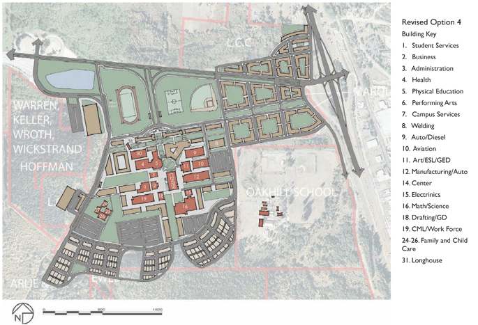
1. Responds to the planning vision.
2. Satisfies all stakeholder comments.
3. Meets the Design Principles – highlights include:
a. The goal of equitable accessibility provides optimal wayfinding throughout campus by defining gateways and setting up a hierarchy of paths, while maintaining a 1500-foot walk perimeter between convenient bus stops.
b. The vision supports the goal of complete community by proposing support districts that could facilitate services and amenities like campus cafes, housing, retail, and places to play to the LCC community, while maintaining the educational mission by providing varied places to learn.
c. The vision works within the context of sustainable building and landscape practices by utilizing buildings to create shaped pathways and space linked by campus quads that preserve view corridors and hide small parking lots.
4. Preserves a majority of LCC’s unbuildable land holdings as natural and native habitat for recreation and education.
5. The recreation fields and pond create a verdant front entry providing ‘curb appeal’ and a clear view out from and in to campus.
6. Requires minimal building demolition.
7. Replaces the multilayered campus core with a universally designed tiered campus.
8. Creates connections to the surrounding landscape.
9. Adds great streets that link the mixed-use district to the campus core and lower density residential neighborhood maximizing the use of buildable land.
10. Provides an alternative revenue stream through the development of housing, commercial, and retail spaces.
1. The track is ready for renovation. If the renovation was to proceed as planned it would halt the primary design implementation: the new entry sequence, green fields as the front door and primary north south link into campus.
2. Per this vision, one of the three retention ponds would be removed, while the remaining ponds would stay connected to the new wastewater treatment plant.
3. The Performing Arts building is slated for several additions that would not add to the building structure forming the main east west quad. By waiting, a new design could add to the civic structure of campus and furthermore create additional space not planned in the current addition.
4. The Center Building is a mega structure that currently disrupts the flow movement, ease of access and adds the separation of space on many levels. A renovation of the interior and exterior space could draw light into the building and add to the campuses civic structure. It could literally become the beating heart to an ever-active campus.
5. Building seventeen (Forum) is one of two buildings proposed for demolition in this vision. The removal of the Forum building would allow for better wayfinding, civic structure through linking spaces from the upper, middle, and eventually, lower campuses.
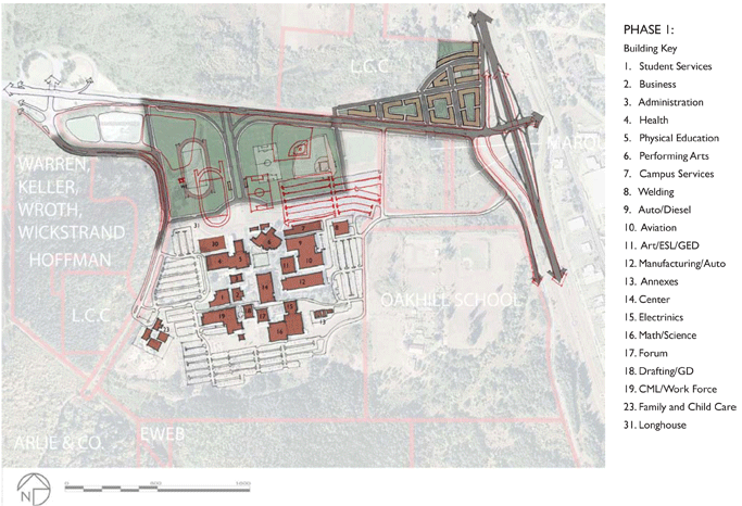
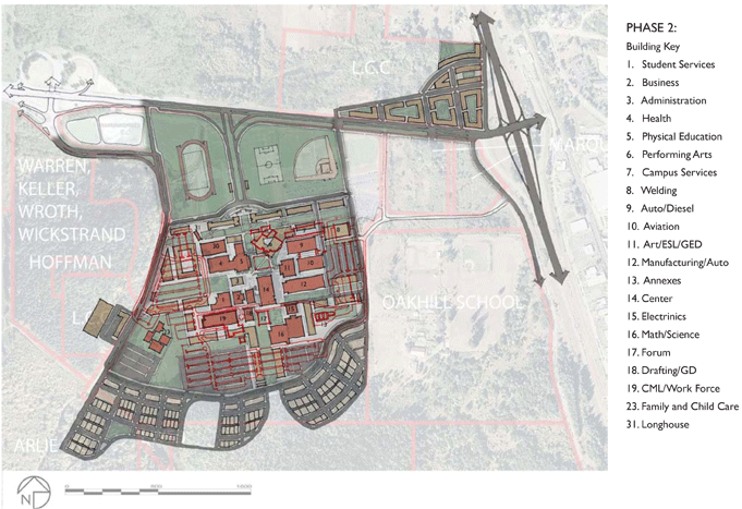
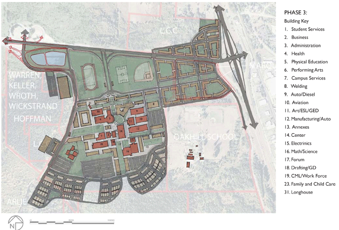
The following images detail proposed phasing drawings for implementation of the development vision. Facilities shown in rust are existing facilities. Those shown in red are being removed during that phase and those shown in illustration are additions during that phase.
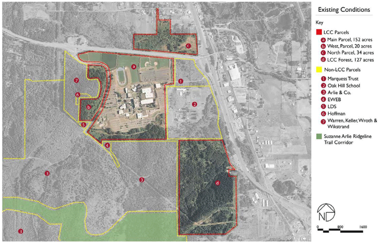
This map shows the LCC and adjacent area parcels including the extention of the Ridgeline Trail at a scale that will be used from here forward.
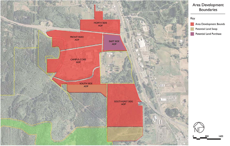
This map shows one scenario of how LCC can divide its and surrounding land into detailed development scenarios. Three distinct phases of development are represented here and in the following development option: 1) LCC Owned Land, 2) the possibility for a Land Swap or easement with Arlie to connect the South-East Side ADP to the South Side and Campus Core, and 3) the possibility to Purchase land for future development.
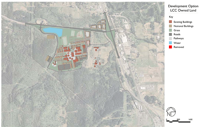
REVISED DEVELOPMENT OPTION 5 LCC OWNED LAND
Using comments from the Lane Community College Open House, and subsequent meetings with the athletic pug, the Urban Design Lab incorporated the strengths from the Revised Development Option 4 and made additional changes from many of the weaknesses.
This revised development option 5 vision focuses on using LCC’s existing portfiolio of land only. It continues to create a higher-density mixed-use commercial district nearest the I-5 interchange and the portion of buildable land on the north side of 30th Avenue, while preserving the existing wetlands.
This option also designed a modified multiway-boulevard (mwb) along 30th Avenue. These streets, common in Europe and Vietnam, have faster moving through traffic in the middle, separated by medians with parking and access lanes on the outside. The slower moving access lanes allows for local traffic – vehicular and bicycle – to gain entrance to shops, apartments, and classrooms. The development on the south and north sides of 30th Avenue use the built form and the road upgrades to mitigate congestion and create a gateway to the LCC community and into Eugene.
The boulevard could be developed piece-meal, as adjacent builable lands are developed. Additionally, the upgrade of 30th Avenue could permit for multiple left-hand turn lanes, traffic signals, and planted medians; create alternative entries into the campus. Resiting the ball fields farther north permits for an optimal visual corridors to and from the campus.
LCC’s two main entrances are designed to divide and slow traffic though the use of planted access lanes and a boulevard bisecting the recreation district at which terminates at a new campus core campus gateway.
The soccer pitch and baseball field are shifter north and east to
make room for the first of two proposed living learning centers
that starts to frame the entry and new east west linear quad. At
the behest of the facilities administrator, the facilities building and
its supporting needs are flipped to the west side of campus making
room for additional new buildings as the need arises. A proposed
renovation of the Performing Arts and Center buildings helps define
a new central courtyard at Bristow Square. No buildings are
removed from this option. Additional support buildings are proposed
that reinforce and shape the civic, open, and teaching spaces
throughout campus.
| PARKING | NEW BUILDINGS (in square feet) | BUILDABLE PARCEL AREA |
| on street --- 987 spaces | minimum --- 2,346,729 | 51 acres |
| off street --- 1,966 spaces | maximum --- 5,510,818 | |
| spaces lost --- 286 |
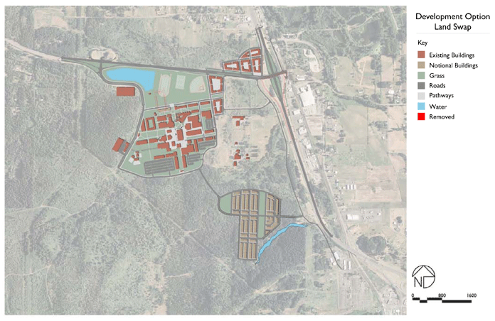
REVISED DEVELOPMENT OPTION 5: SECOND PHASE LAND SWAP
This phased option continues to use current LCC owned land to develop and assume a land swap or easement to gain access to southern LCC forest district.
This option also assumes that the Oregon Department of Transportations (ODOT) will upgrade the current insufficient interchange; we overlaid a single-point urban interchange over the existing condition.
The LCC forest district allows for added residential and commercial development while linking the Suzanne Arlie Ridgeline Trail Connector to the campus. The street framework is made up of main through streets and service alleyways. The below attributes include the calculations from the first phase.
| PARKING | NEW BUILDING (in square feet) | BUILDABLE PARCEL AREA |
| on street --- 2,209 spaces | minimum --- 3,489,909 | 85 acres |
| off street --- 1,966 spaces | maximum --- 7,892,664 | |
| spaces gained --- 936 |
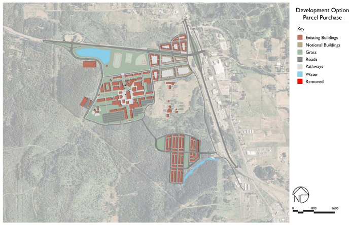
REVISED DEVELOPMENT OPTION 5: THIRD PHASE PARCEL PURCHASE
This phase of development focuses on the purchase of the Marquess Trust land area furhter concentrating development along 30th Avenue up to the south side of the I-5 interchange. Several east west park blocks allow for clear wayfinding and additional green space connecting this district to the campus.
The below attributes include calculations from the first and second phases.
| PARKING | NEW BUILDINGS (in square feet) | BUILDABLE PARCEL AREA |
| on street --- 2,526 spaces | minimum --- 3,743,211 | 119 acres |
| off street --- 3,196 spaces | maximum --- 8,905,872 | |
| spaces gained --- 2,483 |
Lane Community College - Campus Long Range Planning |
